BY KRIS LEONHARDT
EDITOR-IN-CHIEF
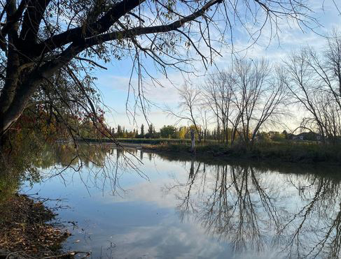
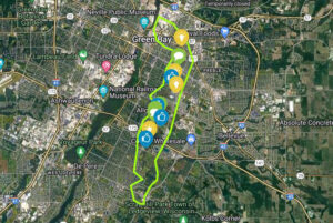
GREEN BAY – A local project group is seeking community feedback as it creates a master plan to ensure year-round accessibility to the East River Recreational Trail, address flooding issues and enhance wildlife habitats along the trail.
“This project was prompted because of flooding that occurred in 2019 due to record high rainfalls, ice melt and wind. The fluctuating water levels in the bay of Green Bay and East River resulted in flooding throughout the cities of Green Bay and De Pere, the villages of Allouez and Bellevue, and town of Ledgeview including portions of the East River Trail which spans throughout these communities,” explained Kaurie Mihm
“This flooding made it difficult to navigate certain portions of the trail which was concerning to the trail users and the municipalities that manage them. Because multiple municipalities were working on this shared issue, there was interest for the communities to partner together to find solutions regarding the flooding. This prompted the creation of a larger partnership with The Nature Conservancy, Wisconsin Sea Grant and NEW Water who partner to make up the East River Collaborative to increase flood resilience in the East River Watershed.
“Project planning began in 2020 which included a needs assessment and municipalities conducting Coastal Resiliency Self-Assessments resulting in a Watershed Framework that was completed in December 2022 (East River Watershed Resilience Framework 2022 | East River Collaborative (tnc.org)). In creating this framework, we realized that the East River Trail was both problematic in terms of flooding and a priority for all the communities through which it passed.
“This particular project focusing on the East River Recreational Trail started last year with the award of a grant from the Wisconsin Coastal Management Program, but the various municipalities and East River Collaborative have been discussing it for several years before that.”
Current community leads on the East River Recreational Trail Master Plan project include Chris Clark, village of Allouez; Kyle Casper, village of Bellevue; Kaurie Mihm and Melissa Schmitz, city of Green Bay; Marty Kosobucki, city of De Pere; and Stephanie Schlag, town of Ledgeview.
The group is further assisted by ISG Local Office Engagement Lead Danyelle Pierquet and Project Manager Paul Marston.
Mihm said that the primary goal of the project is to “identify where flooding occurs on the East River Trail so a comprehensive plan can be developed to correct the flooding issues.”
“Additionally, we are working to improve fish and wildlife habitat along the trail corridor as part of the planning,” she said.
“By implementing proposed projects within the plan, we hope to enhance trail access and use while creating biodiverse and resilient conditions along the river. Although water levels have receded since 2019 and there is currently much less flooding along the trail than there was then, there are still areas of the trail that flood during large rain events. Therefore, projects that are identified in the plan will be prioritized and constructed as funding allows. These efforts will aid in creating a better regional multi-use trail system within Brown County.”
Project leaders say that the quality of the river has also been “degraded” by some of the same issues that increase flooding.
“Water runoff from agriculture and urban areas carries nutrients and other chemicals into the stream. Increases in river flows have also led to erosion of streambanks which results in high amounts of sediment in the river. The increases in nutrients and sediment have negative effects on how the river functions for both wildlife and recreation,” a project handout stated.
The river trail also offers limited access points to get into the river for those wanting to fish, kayak, paddle or canoe.
Public information input includes heavy trail usage, flooding impact and alternative routes during flooding.
To provide input, visit https://isg.mysocialpinpoint.com/east-river-recreational-trail-mas ter-plan/home. The project is currently in the conceptual design phase, with a second open house planned for May.
Design plan completion is expected in June.